LAKE SAREZ NASA IMAGE
Please click on image for enlargement
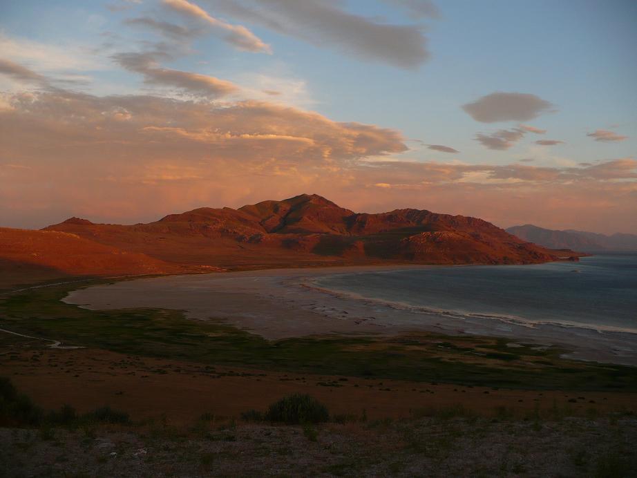
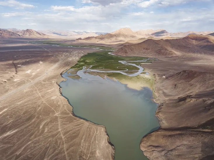
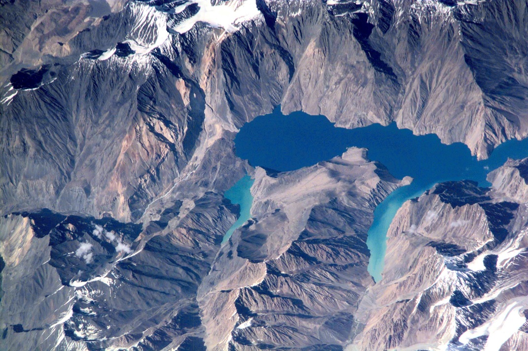 Lake Sarez, deep in the Pamir mountains of Tajikistan, was created 90 years ago when a strong earthquake triggered a massive landslide that, in turn, became a huge dam along the Murghob River, now called the Usoi Dam. The resulting lake is perched above surrounding drainages at an elevation greater than 3000m, and is part of the watershed that drains the towering Akademi Nauk Range (see the regional image, below). The lake is 61 km long and as deep as 500 m, and holds an estimated 17 cubic km of water. The area experiences considerable seismic activity, and scientists fear that part of the right bank may slump into the lake, creating a huge wave that will top over and possibly breach the natural dam. Such a wave would create a catastrophic flood downstream along the Bartang, Panj and Amu Darya Rivers, perhaps reaching all the way to the Aral Sea. Currently, central Asian governments, as well as the World Bank and the UN are monitoring the dam closely, and have proposed gradually lowering the lake level as a preventive measure. Image: NASA Earth Observatory; digital photograph was taken in the spring of 2001 from Space Station Alpha and is provided by the Earth Sciences and Image Analysis Laboratory at Johnson Space Center.
REMARKS BY HIS HIGHNESS THE AGA KHAN
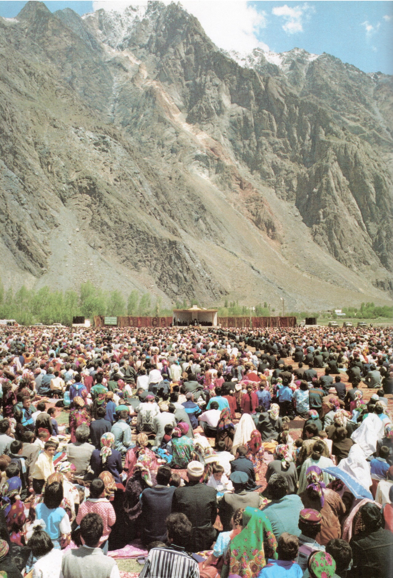
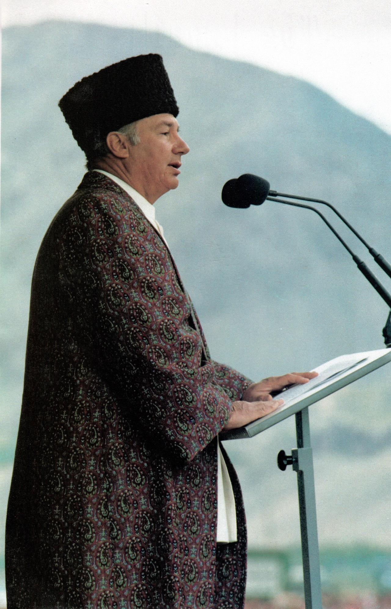
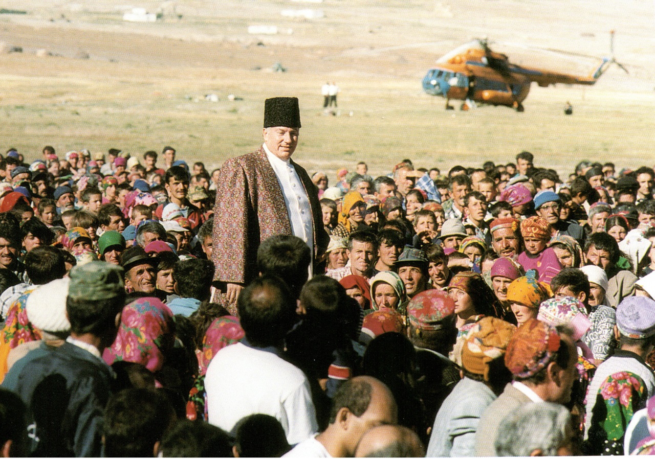
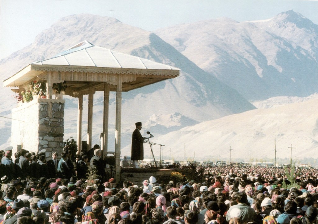
“…From a global perspective, it is here, in Central Asia, that one of the most unusual water situations exists. I am referring to Lake Sarez. It is some 60 kilometres in length, containing some 17 cubic kilometres of water, is at 3200 meters altitude and has a natural dam of 550 meters, the highest of any dam in the world. For years it has been seen as a major hazard to millions of lives in this country [Tajkistan] and in Afghanistan, Uzbekistan, Turkmenistan and Kazakhstan. It is clear that if the rock dam, caused by an enormous landslide following an earthquake in 1911, were to break as a result of another such event; or if another earthquake were to cause landslides to fall into the lake, raising the level of the water and causing a massive spill across the top of the dam, the consequence would be a major catastrophe. It is estimated that 5 million lives could be at risk. Fear of this happening has dominated the thinking of government officials and the population living in the area around and below Lake Sarez for years.
“More recently the World Bank, the Aga Khan Development Network (AKDN), USAID and the Swiss Government have expended time, thought and resources to develop a credible protective response that can alert downstream populations as quickly as possible. In simple terms, this is risk management. The question I wish to raise today is whether we are not perhaps also facing a question of opportunity management. Thousands of cubic meters of consumable water are trapped at high altitude. Is this not a situation which could be turned into a force for development, rather than a threat of tragedy? Studies are presently underway to test this idea, in particular in regard to the use of the Sarez Lake waters for hydro energy and irrigation for the area they now threaten, and probably much more. Any wisdom that this conference could bring to bear on these issues would be an extremely valuable outcome…” — Excerpts from a speech made by His Highness the Aga Khan, 49th hereditary Ismaili Imam, at the Dushanbe Fresh Water Forum (Dushanbe, Tajikistan), August 30, 2003.
~~~~~~
ACTION TAKEN
In 2004, a special satellite equipment and early warning system for monitoring the situation around Lake Sarez was installed by a World Bank project working on risk mitigation in the area, a step to ensure early warning for the vulnerable population in the region.
According to an interview with IRIN (Humanitarian News and Analysis), Rustam Bobojonov, a coordinator of the project said that “the equipment is for monitoring the situation around Lake Sarez, the dam and the Bartang valley, including seismic activity, landslides, water, wind speed and so on. It is aimed at ensuring early warning for the Tajik government, including the emergency ministry, international community and the residents of all the villages in the Bartang Valley about the possible risk.”
The total cost of the project was at US$4.5 million out of which the Aga Khan Foundation contributed US$1, with the Swiss Government providing another US$2.9 million.
~~~~~~
Background Article
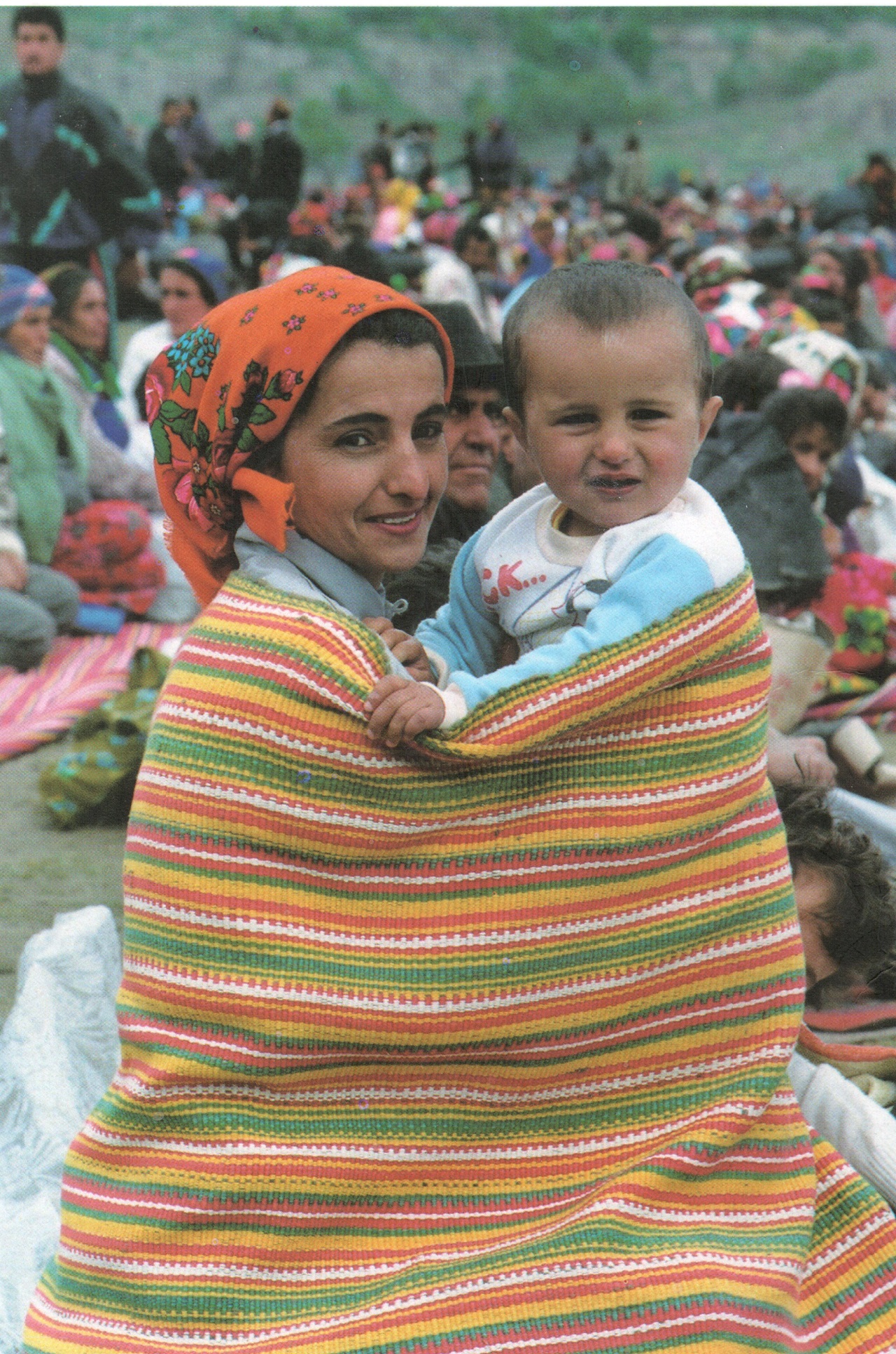
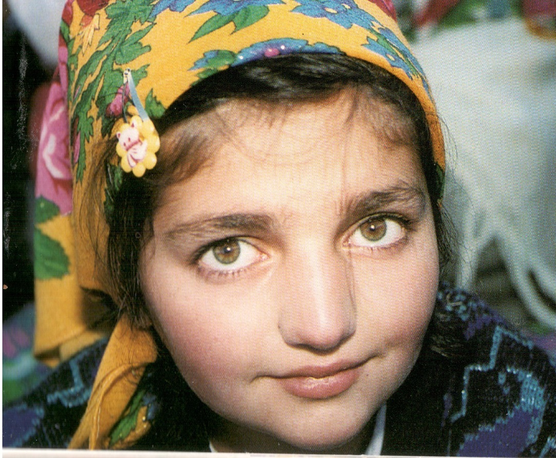
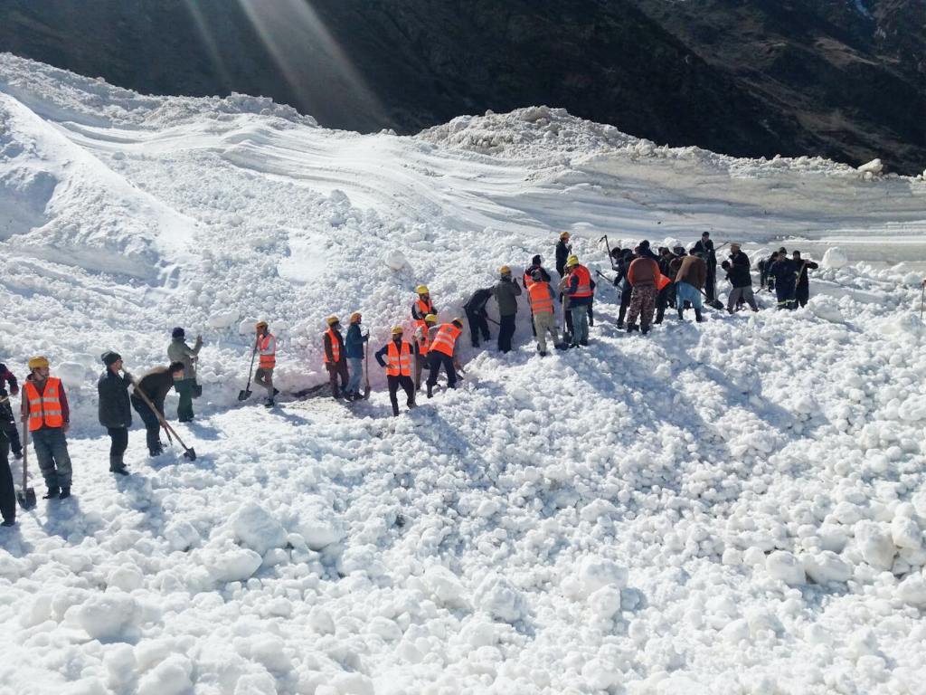
“…Below the Usoi dam there are more than 30 small villages in the Bartang Valley, with a total population of about 7,000 mountain Ismaili people. Most villages (kishlaks) are sited on alluvial cones near to the river and use all available gently sloping land. Many of the villages are subject to floods, landslides, mudflows, and avalanches annually…”
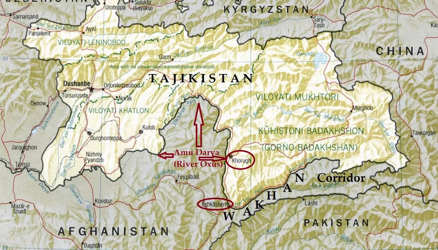
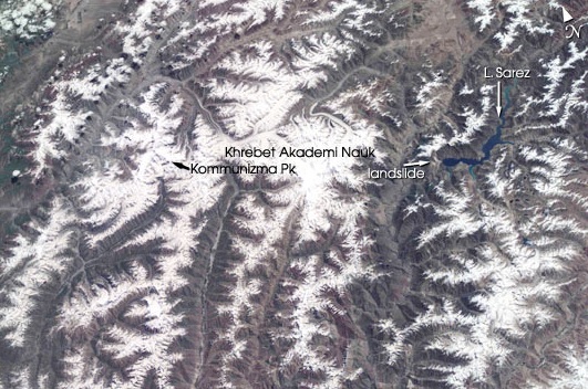
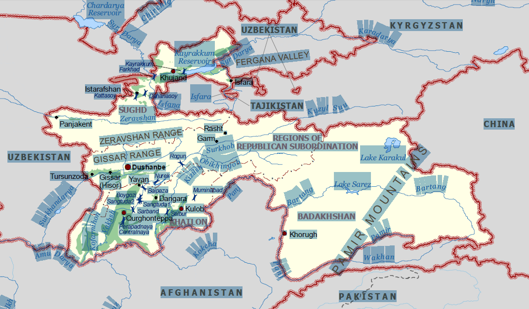
TAJIKISTAN: LAKE SAREZ AND THE PAMIR MOUNTAINS
Please click on map for enlargement.
 Please click on map for enlargement. This map has been adapted from the original map produced on the website of FAO.
(Map shown above and the following article have been adapted from the website of the United Nations Food and Agriculture Organization, FAO, see link below)
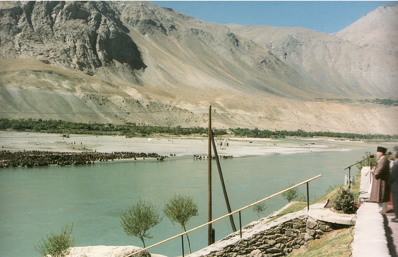
Lake Sarez, high in the Pamir Mountains is close to 3,000 m above sea level and its location is one of the most remote in the world. It formed following a very large landslide, set off by an earthquake in the winter of 1911. The landslide, with a volume of some 2-3 km3 , plunged down a mountain side to form a dam between 500 and 600 metres in height and two kilometres wide to block the Murgab River. This river is a tributary of the Bartang River which, below the confluence with the Murgab, flows for 120 km through a gigantic mountain gorge to join the Pianj River, itself a tributary of the Amu Darya. The Amu Darya is one of the two major rivers that drains into the Aral Sea 2,000 km below the dam site. The Pianj and Amu Darya rivers form part of the frontier between Tajikistan and Afghanistan and further downstream their combined waters flow through Uzbekistan and Turkmenistan. The fallen mass of rock and earth was named the Usoi Dam after the village that it completely annihilated. The dammed waters of the Murgab River produced Lake Sarez, named for a village that was submerged by the rising waters. Initially, the level of the lake rose at a rate of about 75 metres a year.
Today it is more than 60 km in length and has a maximum depth in excess of 500 metres. Its total volume is about 17 km3. The lake surface is close to 3,200 m above sea level and surrounded by peaks rising to more than 6,000 m. The Usoi dam is the highest dam, natural or man-made, in the world. Set in the heart of the Pamir Mountains, the lake itself and its surroundings form a magnificent mountain landscape.
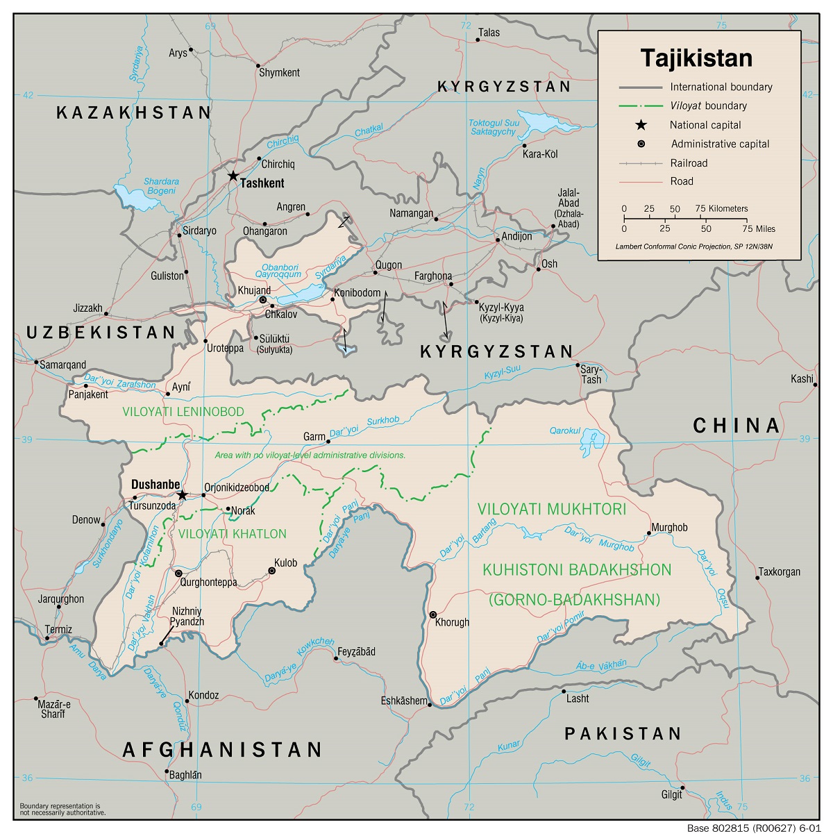
It is also located in a region that has been central to major political and military tensions for more than 200 years. During the 19th and early 20th centuries the three rival empires, Czarist Russia, Great Britain, and China competed on a gigantic and heroic scale that became known, following the writing of Rudyard Kipling, as the ‘Great Game’. Much earlier a main branch of the Silk Road passed through the Pamir and carried Marco Polo and his uncles to the court of Kublai Khan. The present republics of Central Asia were moulded by Soviet Russia from a series of Khanates, together with territories of no clear political allegiance. Currently, with a massively disturbed Afghanistan, Pakistan, Kashmir, and India, all virtually within walking distance, and with Iran, Iraq, and Turkey as neighbours with more than a passing interest, political instability may seem the order of the day. The Pamir Mountains, in general, represent one of the most active seismic regions on the world’s geophysical map.
Lake Sarez, therefore, is a focal point for a great amount of concern. A disaster of significant proportions could be triggered in several ways. A major earthquake could shatter the Usoi dam and send an enormous flood wave down the Bartang Valley and into the Pianj and Amu Darya rivers; the dam could collapse under the pressure of the water as the lake continues to rise; the piping of water through the dam, which is occurring today, could enlarge and cause the dam to collapse; or collapse could be induced by the continued rise of the lake level and eventually over-topping it. Finally, another large landslide, caused either by an earthquake, or the spontaneous failure of the mountain wall above the lake, could fall into the lake and generate a giant wave to over-top the dam. Even if the dam was not broken by such a wave, the wall of water rushing down the Bartang Valley could set off fast moving mudflows and trigger secondary landslides by under-cutting the talus slopes along the valley sides. This could be sufficient to eliminate all the thirty villages in the valley, and even more as the disturbance entered the Pianj Valley.
It has been estimated that, in the worst case, the lives of five million people could be affected. Furthermore, the torrential flood waters could extend as far downstream as the Aral Sea itself, with the additional danger of disturbing the toxic sediments that have been exposed as the sea has dried up.
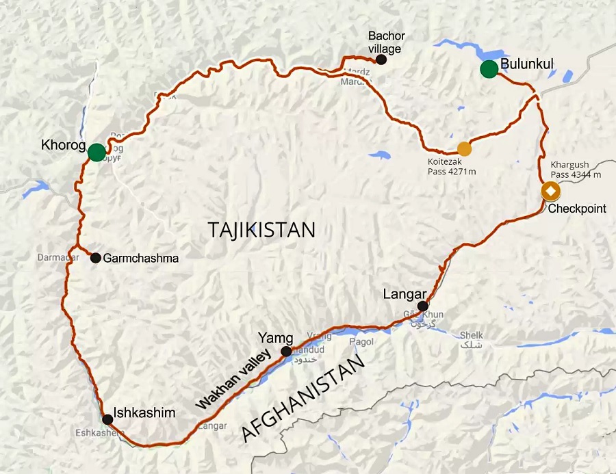
The problem is rendered the more complex by a number of other factors. The vicinity of Lake Sarez is extremely remote and physical access along the Bartang Valley is a challenge. The final approach to the dam involves a difficult ascent on foot along steep mountain slopes, with a gain in altitude of more than 1,000 metres. This would render road construction, if heavy equipment would be needed, extremely expensive and technically difficult to maintain. The regional approach also constitutes a challenge; there are two main roads into the upper Pianj Valley and Khorog, the regional capital. One of these is very long and involves transit through a small part of the territories of Uzbekistan and Kyrgyzstan and a high altitude section (above 4,000 m) across the Pamir Plateau. The other, more direct, requires passage of the Pianj gorge, with very unstable slopes and a narrow road bed subject to rockfall, mudflow, landslide, and avalanche. Both roads are closed by heavy snow for several months of the year. The difficulty of access alone would appear to eliminate large-scale engineering solutions, such as reinforcing the dam artificially, or attempting a controlled partial drainage and lowering of the lake level.
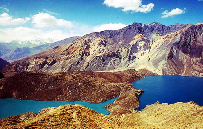
The naturally formed Usoi dam separates the Sarez (right) and Shadau (left) lakes. Photo: Wikipedia.
Below the Usoi dam there are more than 30 small villages in the Bartang Valley, with a total population of about 7,000 mountain Ismaili people. Most villages (kishlaks) are sited on alluvial cones near to the river and use all available gently sloping land. Many of the villages are subject to floods, landslides, mudflows, and avalanches annually; while these natural hazards are individually of small magnitude, compared to that posed by a potential failure of the Usoi dam, they are frequent in occurrence and constantly restrict access to the valley and would constrain any needed evacuation. Any landslide-induced flood wave capable of over-topping the dam would place all or most of the villages at risk. Soviet and Tajik scientists became aware of the threat posed by Lake Sarez some decades ago. Early warning and lake-level monitoring systems were established. The warning signals, however, were only directed to Moscow and Dushanbe. Thus, in the event of a medium- or large-scale flood, any secondary warning to reach the Bartang villages from either Moscow or Dushanbe would likely arrive after the event, if at all. With the collapse of the USSR even this approach to early warning and lake-level monitoring ended.
Then followed the civil war of 1992-1997 when the problem of Lake Sarez was put aside. Over the last three years, the dangers posed by Lake Sarez have begun to be taken seriously. Various reconnaissance visits have been made to the lake and dam and to the Bartang Valley. Several high-level planning meetings have been held: in Dushanbe, Geneva, and Washington, DC. The involved Asian republics, and especially Tajikistan, appear to favour a development approach based on the assumption that the worst case scenario (total collapse of the Usoi dam) was credible. A major investigation was mounted during June 1999. This was financed primarily by the World Bank, with additional support from the UN disaster relief organization, Focus Humanitarian Assistance (one of the Aga Khan family of organizations), and the government of Tajikistan. An international group of engineers, geophysicists, geologists, and geographers visited Lake Sarez and examined all the approach routes. There was unanimous agreement that the prospect of a worst case scenario was sufficiently remote that it should be accorded a low level of priority. However, there was strong support for installation of monitoring and early warning systems. Unlike the earlier Soviet approach, the new approach would relate to all the villages in the Bartang Valley and ensure the direct input of the local people. Concurrently, it was recommended that computer mapping and simulation of the potential impacts of various levels of natural disaster be undertaken. It was also pointed out that further, and much more detailed, studies should be undertaken of the cultural and socioeconomic situation of the local people. Sites for safe havens should be located and equipped, and a full accounting made of the attitudes of the local people toward the various levels of possible danger. One additional, and very important point, is that steps should be taken to ensure that the likelihood of actual large-scale disaster (worst case scenario) not be over-stated, so that the risk of any government-ordered forced evacuation of the Bartang Valley could be avoided. By February 2000 it appeared that, under the leadership of the World Bank and with contributions from several major donors, the recommendations of the June 1999 reconnaissance team were to be acted upon (United Nations, 2000). A year later, at time of this writing, significant planning progress has been made. Thus, the case of Lake Sarez, while representing one of the largest ever potential disasters based upon a natural situation in a high mountain region, embraces many complex inter-relations between highlands and lowlands. Ultimately, the challenging task of seeking collaboration amongst several independent countries on the use and management of a large international river, the Amu Darya and its headstreams, will have to be faced. Given the international rivalries prevailing in the region, this might well be the single most difficult task. Nevertheless, while the magnitude of the problems emanating from the potential instability of Lake Sarez may be an order of magnitude, or more, higher than other mountain hazards in the same region, their identification, evaluation, and treatment should provide a formula for ways in which other hazardous situations could be approached.
Date posted: October 31, 2015.
_________________
Credits:
- For complete speech of His Highness the Aga Khan, please visit http://www.akdn.org.
- Please visit http://www.nasa.gov for images of Lake Sarez
- For complete background article, please visit http://www.fao.org and enter Lake Sarez in the search box.