Simerg is an independent initiative dedicated to Ismaili Muslims, the Aga Khan — their Hereditary Imam — and the Ismaili Imamat, and Islam in general through literary readings, photo essays and artistic expressions
The David Rumsey Historical Map Collection focuses on 16th through 21st century maps of North and and South America, as well as maps of the World, Asia, Africa, Europe, and Oceania. Atlases, globes, school geographies, maritime charts, and a variety of separate maps including pocket, wall, children’s and manuscript maps are present on the website. The depth and breath of the digital collection is impressive, and is continuously growing. The website notes that the actual physical map collection is housed at the David Rumsey Map Center at the Stanford University Library.
My search on the website using the term “Fatimid” yielded one result. It is a map produced in 1924 by the Survey of Egypt, which was once regarded as “one of the most professional mapping agencies in the World, predicated upon the synergy of the most authoritative topographical and urban mapping combined with the latest archaeological surveys.”
Simerg is pleased to reproduce the map, along with an interesting narrative that accompanies the map on the David Rumsey Map Center website. We also invite readers to click on the link to enrich their viewing experience of the map, download the map (by using the Export Function) as well as to explore other maps that may be of interest to readers or to provide them with further information in their specific area of research.
Cairo During the Islamic Golden Age
Please click on image for enlargement
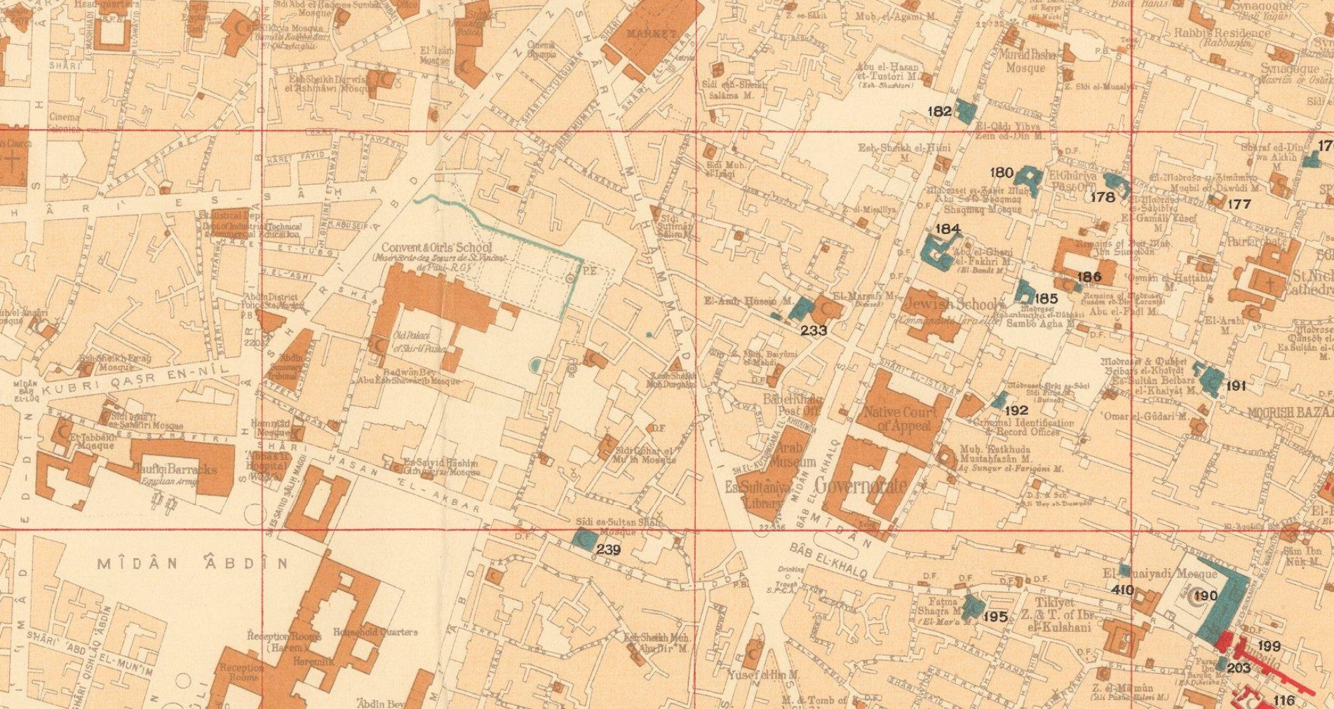
Map of Cairo showing Islamic monuments, with the ‘Fatimid and Pre-Fatimid Monuments’ (909 – 1171), shaded in Red; the ‘Aiyubid [Ayyubid] Monuments’ (1171 – 1260), shaded in Green; and the ‘Mameluke Monuments’ (1260 – 1517), shaded in Blue. Credit: David Rumsey Map Collection, David Rumsey Map Center, Stanford Libraries. This work is licensed under a Creative Commons License.
Cairo was the greatest centre of culture, learning and commerce during the ‘Islamic Golden age’. Commencing in the early 20th Century professional archaeologists as well as art and architectural historians became interested in scientifically recording Cairo’s sensational Islamic buildings and monuments.
The map employs colours to denote sites built across the city during the eras of the three great Islamic empires that controlled Cairo prior to the arrival of the Ottomans in 1517: the ‘Fatimid and Pre-Fatimid Monuments’ (909 – 1171), shaded in Red; the ‘Aiyubid [Ayyubid] Monuments’ (1171 – 1260), shaded in Green; and the ‘Mameluke Monuments’ (1260 – 1517), shaded in Blue.
These mosques, palaces, madrassas, and fortifications appear amidst the otherwise buff-coloured city which generally consisted of buildings built during the subsequent Ottoman and British Protectorate periods.
The map shows that many of the greatest edifices from the periods of the three great Islamic empires have survived, although only traces of the vast Fatimid Place can be found amongst the foundations of newer buildings. Each of the historical sites is named in Gothic script and features a corresponding numeral which refers to that which appears upon the plaques affixed to each building by the civic authorities. The two insets on the left-hand side showcase sites in areas outside of the city proper. We understand that the first edition the map was issued in 1924, while an Arabic language version was published in 1948. The present revised, official edition was issued in 1950-1 (correction, this copy is the first edition, issued in 1924), while several facsimile (unofficial) versions have been issued since then. The Survey of Egypt followed the initial production of the present issue of the map with a small booklet, Index to Mohammedan monuments appearing on the special 1:5000 scale maps of Cairo (Cairo, 1951), that is not present here, but seems to have been issued with the latter-releases of the map.
Cairo during the ‘Islamic Golden Age’ Cairo was traditionally the largest and most culturally and economically important city in the Islamic world. The Muslim conquest of Byzantine Egypt occurred between 639 and 646 AD. While the Cairo area has been settled for thousands of years, with the key Ancient Egyptian cities of Giza and Memphis located nearby, the city proper was not founded until 969, when it became the principal city, and sometimes capital, of the Fatimid Caliphate, a Shia Muslim empire which controlled much of North Africa, the Levant and Hejaz between 909 and 1171.
Cairo rapidly rose to become a centre of great wealth, at the nexus of global trade routes as well as home to some of the world’s foremost centres of education and the arts. Befitting its importance, great monuments of Islamic architecture were built across the city.
The Al-Azhar Madrassa (no. 97 on the map), which later grew into a university, was founded in 970-2 and today remains the world’s most prestigious institute of Islamic learning. The map notes some Islamic monuments made before 969, as the pre-Cairo rural landscape featured some small mosques, houses and fortifications.
The Fatimids were replaced by the Ayyubid Dynasty (1171 – 1260), a regime of Kurdish origin, founded by the legendary conqueror Saladin, whereupon Cairo remained the prosperous centre of an empire spanning much of the Middle East.
The Mamelukes were an elite class of soldier-bureaucrats descended from former Christian slaves. In 1250, they took over Egypt, the Levant and Hejaz, forming the Mameluke Sultanate, with its capital in Cairo. It was during the early part of their regime that Cairo reached its zenith as the principal centre of the Islamic Golden Age.
The epicentre of a global trading network that spanned from India to Spain, Cairo far surpassed all European cities in wealth and cultural sophistication, and many exquisite works of architecture were built to reflect this glorious state. The Mameluke Sultanate was conquered by the Ottomans in 1517 and Cairo ceased to be an imperial capital. However, while technically subject to the Sublime Porte, Egypt maintained a high degree of autonomy and was the wealthiest and most prosperous part of the Ottoman Empire; Cairo remained a highly important centre.
Fortunately, as the repent map reveals, the survival rate of Cairo’s great works of Islamic architecture from the Fatimid, Ayyubid and Mameluke periods is impressively high, and many sites can be visited today. References: OCLC: 17543226. (Alexander Johnson, 2020).
Date posted: February 22, 2022.
________________________
Before leaving this website please take a moment to visit Simerg’s Table of Contents for links to hundreds of thought provoking pieces on a vast array of subjects including faith and culture, history and philosophy, and arts and letters to name a few. Also, visit Simerg’s sister websites Barakah, dedicated to His Highness the Aga Khan, and Simergphotos that features photos and videos from around the world.
Malik, the founding publisher and editor of the 3 websites, may be reached at his email address, mmerchant@barakah.com.
“For brief period of history, the Fatimid Caliphate based in Egypt presided over arguably the most powerful empire in the Mediterranean. Yet because the legacy of this Ismaili dynasty was erased or downplayed by its Sunni rivals and successors, the Fatimids are often misunderstood. As we show in this installment of “The Making of the Islamic World,” the Fatimid period and the sources that survive from it can in fact be critical to learning more about how pre-modern Islamic polities functioned, demonstrating that the Fatimids had a much more sophisticated state apparatus than some have assumed.” — Excerpt from article on the website Ottoman History Podcast
Fragments of the Fatimid Caliphate is episode 3 in a series of presentations on the Islamic world by Ottoman History Podcast, which has grown to be one of the largest digital resources for academic discussion concerning the Ottoman Empire and the modern Middle East. The recorded interviews and lectures, while still largely academic in tone, provide scholarly conversation accessible to a wider public audience.
In the broadcast, narrator Chris Gratien interviews Marina Rustow, a social historian of the medieval Middle East at Princeton University. Marina has worked extensively on the documents of the Cairo Genizah, and her published works include Heresy and the Politics of Community: The Jews of the Fatimid Caliphate (2008) and The Lost Archive: Traces of a Caliphate in a Medieval Synagogue (2020).
Date posted: July 23, 2021.
_____________________
Before departing this website please take a moment to review Simerg’s Table of Contents for links to hundreds of thought provoking pieces on a vast array of subjects including faith and culture, history and philosophy, and arts and letters to name a few. Also visit Simerg’s sister websites Barakah, dedicated to His Highness the Aga Khan, and Simergphotos.
Alwaez Jehangir and Alwaeza Maleksultan Merchant pictured at Gatineau Park during their visit to Ottawa in 2007.
Thursday May 27, 2021, will be the 3rd anniversary of the passing of Jehangir Merchant (December 13, 1928 – May 27, 2018), father of Malik (publisher and editor of this website), Fahar and his wife Nina, Alnoor and his fiance Shellina; grandchildren Naim and Nurin; and sister Banu. Our mother and grandmother, Maleksultan (popularly known as Mrs. Merchant), who was our dad’s partner of 66 years, was then still alive; she passed earlier this year on January 21, 2021. This website was launched twelve years ago in the spring of 2009 with their encouragement, guidance and support. The first piece published in Simerg was entitled The Mystery of the Missing Mount Nasir Khushraw.
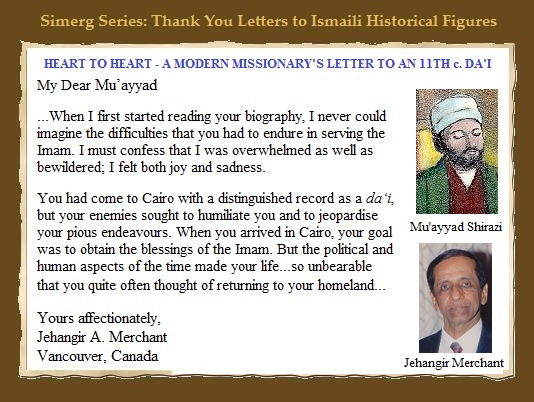
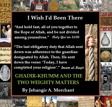
Among several articles by my dad that were published on Simerg, two original contributions that absolutely stand out and are a must read are (1) a letter of gratitude to his greatest hero in Ismaili history, the Fatimid missionary Muayyad din Shirazi and; (2) Ghadir Khumm and the Two Weighty Matters for the acclaimed series I Wish I’d Been There. Please read the two pieces by clicking on the hyperlinks I have provided in the preceding sentence or on the two images shown below.
Please click on image to read Jehangir A. Merchant’s thank you letter to Fatimid missionary Al-Mu’ayyad al-Shirazi
*******
Please click on image to read Jehangir A. Merchant’s “Ghadir-Khumm and the Two Weighty Matters”
We fondly remember our parents and grandparents, and pray for the eternal peace of their souls. Ameen.
“The profile of the coins found in the juglet are a near perfect reflection of the historical events. This is a time of great political change as control of Israel shifts from the Sunni Abbasid caliphate, which sits in Baghdad, Iraq, to its Shiite rivals, the Fatimid dynasty of North Africa.” — Robert Cole
[The following compiled piece includes material released by the Israel Antiques Authority. Also, the website livescience has prepared a short video highlighting the discovery of the Abbasid and Fatimid coins. Please watch the video HERE — Ed.]
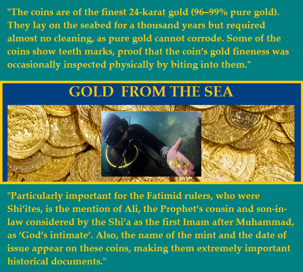
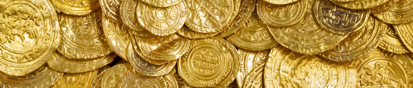
In 2015, in a post entitled Sea of Gold, Simerg provided a link to a special on-line exhibit about the discovery by a group of divers of a hoard of Fatimid gold dinars lying on the seabed in the ancient harbor in Caesarea National Park. The divers alerted marine archaeologists of the Israel Antiquities Authority (IAA), who conducted a salvage excavation at the site and recovered more than 2,580 Fatimid coins of pure (24 karat) gold weighing a total of 7.5 kg.
The IAA then noted as follows: “The coins are of the finest 24-karat gold (96-99% pure gold). They lay on the sea-bed for a 1000 years but required almost no cleaning, as pure gold cannot corrode. Particularly important for the Fatimid rulers, who were Shi’ites, is the mention of Ali, the Prophet’s cousin and son-in-law considered by the Shi’a as the first Imam after Muhammad, as ‘God’s intimate’. Also, the name of the mint and the date of issue appear on these coins, making them extremely important historical documents.”
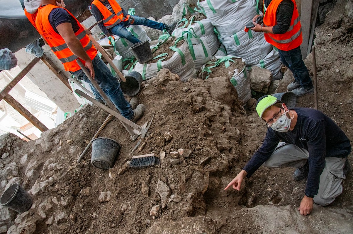
Just over a month ago, on November 9 2020, IAA archaeologists reported another very significant find at a site where an elevator is being built at the Old City of Jerusalem in the Jewish quarter to make the Western Wall more accessible.
Story continues below
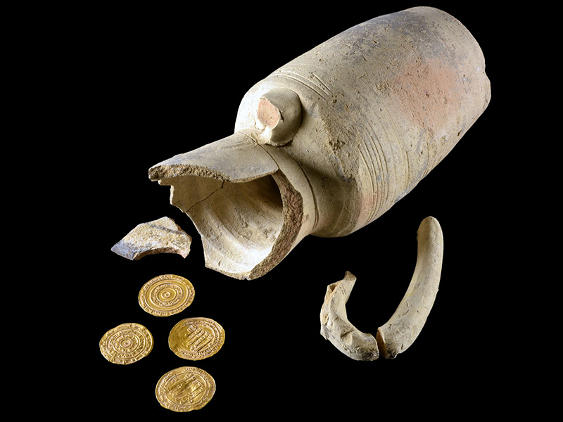
The juglet and the four gold coins found recently in Old Jerusalem. Photo: Dafna Gazit / Israel Antiquities Authority.
David Gellman, the director of the excavation observed, “We seem to have found an ancient savings bank!” He was actually referring to a small pottery urn containing four pure gold coins more than a thousand years old that was found by the inspector of the Israel Antiquities Authority, Yevgenia Kapil, during preliminary work that was carried out at the site during the holidays. Gellman says that when he emptied the jug a few weeks later, the four glittering gold coins along with sand were washed into his hands. This was the first time that Gellman, as an archaeologist, had discovered gold and he was immensely excited by the discovery.
Story continues below
Excavation director David Gellman with the Israel Antiquities Authority points to the spot where the gold-filled jug was found opposite the Western Wall Plaza in Old Jerusalem. Photo: Yoli Schwartz / Israel Antiquities Authority.
Dr. Robert Cole, an expert on coins at the IAA, noted as follows about the four coins: “The coins were preserved in excellent condition and could be read immediately even without being cleaned. The profile of the coins found in the juglet are a near perfect reflection of the historical events. The coins date to a relatively brief period, from the late 940s to the 970s CE. This is a time of great political change as control of Israel shifts from the Sunni Abbasid caliphate, which sits in Baghdad, Iraq, to its Shiite rivals, the Fatimid dynasty of North Africa, which in those days conquered Egypt, Syria and Israel. These historical events are reflected almost perfectly in the distribution of the coins discovered in the jug: two gold dinars were minted in Ramla, under the rule of the Caliph Matia (946 – 974 CE) and the governor on his behalf, Abu al-Qassem ibn al-Ihshid Onuhar (946 – 961 CE). The other two gold coins were minted in Cairo, by the Fatimid rulers al-Mu’iz (953 – 975 CE), and his successor — al-Aziz (975 – 996 CE).”
Story continues below
IAA coin expert Robert Kool examines one of the gold coins found in a small pottery urn. The coins were preserved in excellent condition and could be read immediately even without being cleaned. Photo: Shai Halevi / Israel Antiquities Authority.
He also explained that “the four gold dinars was a considerable sum of money for most of the population, who lived under difficult conditions at the time. It was equal to the monthly salary of a minor official, or four months’ salary for a common laborer.” This is the first time in fifty years that gold coins from the Fatimid period have been discovered in Jerusalem’s Old City. The previous find of 5 coins and jewellery hoards from the Fatimid period took place after the Six Day War south of the Temple Mount, not far from the recent new discovery.
Date posted: December 22, 2020.
_____________________
Before departing this website please take a moment to review Simerg’s Table of Contents for links to hundreds of thought provoking pieces on a vast array of subjects including faith and culture, history and philosophy, and arts and letters to name a few.
We welcome feedback from our readers. Please complete the LEAVE A REPLY form below or, if you don’t see the box, please click Leave a comment. Your letter may be edited for length and brevity, and is subject to moderation.
The Lost Archive by Marina Rustow, published on January 14, 2020 by the Princeton University Press; Pages: 624; Size: 7 x 10 in. Illus: 83 color + 17 b/w illus. 4 maps. 4c throughout. To purchase hardcover, Kindle or Kobo versions see links at bottom of this page.
Grabbing our attention now is a splendid new book on the Fatimids that looks at the caliphate’s robust culture of documentation. In an editorial review of the book, Konrad Hirschler of the Freie Universität Berlin describes Marina Rustow’s work “as a veritable magnum opus that will remain a point of reference for decades to come.” He also notes that “there are few books like this one that take the reader on such a long-distance journey across centuries and writing systems.”
The Lost Archive: Traces of a Caliphate in a Cairo Synagogue is Marina Rustow’s second work on the Fatimids. Her first one was entitled Heresy and the Politics of Community: The Jews of the Fatimid Caliphate. Sheis the Khedouri A. Zilkha Professor of Jewish Civilization in the Near East and professor of Near Eastern studies and history at Princeton University. She is director of the Princeton Geniza Lab and a MacArthur fellow. Her latest work is also praised by Geoffrey Khan, University of Cambridge, who states that “with great historiographical skill, Rustow brings new insights into the history of the medieval Middle East through a holistic analysis of the surviving state documents of the Fatimid dynasty. This is a splendid book.”
Marina Rustow has made very interesting and informative presentations of her research and work at the American Philosophical Society and the University of New Mexico. Links to both the videos are provided at the end of this piece.
The lost archive of the Fatimid caliphate survived in an unexpected place: the storage room, or geniza, of a synagogue in Cairo, recycled as scrap paper and deposited there by medieval Jews. In the book Marina Rustow tells the story of this extraordinary find, inviting readers to reconsider the longstanding but mistaken consensus that before 1500 the dynasties of the Islamic Middle East produced few documents, and preserved even fewer.
Beginning with government documents before the Fatimids and paper’s westward spread across Asia, Rustow reveals a millennial tradition of state record keeping whose very continuities suggest the strength of Middle Eastern institutions, not their weakness. Tracing the complex routes by which Arabic documents made their way from Fatimid palace officials to Jewish scribes, the book provides a rare window onto a robust culture of documentation and archiving not only comparable to that of medieval Europe, but, in many cases, surpassing it. Above all, Rustow argues that the problem of archives in the medieval Middle East lies not with the region’s administrative culture, but with our failure to understand preindustrial documentary ecology.
Illustrated with stunning examples from the Cairo Geniza, this compelling book advances our understanding of documents as physical artifacts, showing how the records of the Fatimid caliphate, once recovered, deciphered, and studied, can help change our thinking about the medieval Islamicate world and about premodern polities more broadly.
The hard copy or electronic Kindle version of “The Lost Archive” may be purchased at the following websites: Princeton Amazon & Amazon Canada Indigo
Date posted: March 8, 2020.
__________________
American Philosophical Society presentation by Marina Rustow (34 minutes)
~~~~~~~~~~~~
University of New Mexico presentation by Marina Rustow (1 hour 35 minutes)
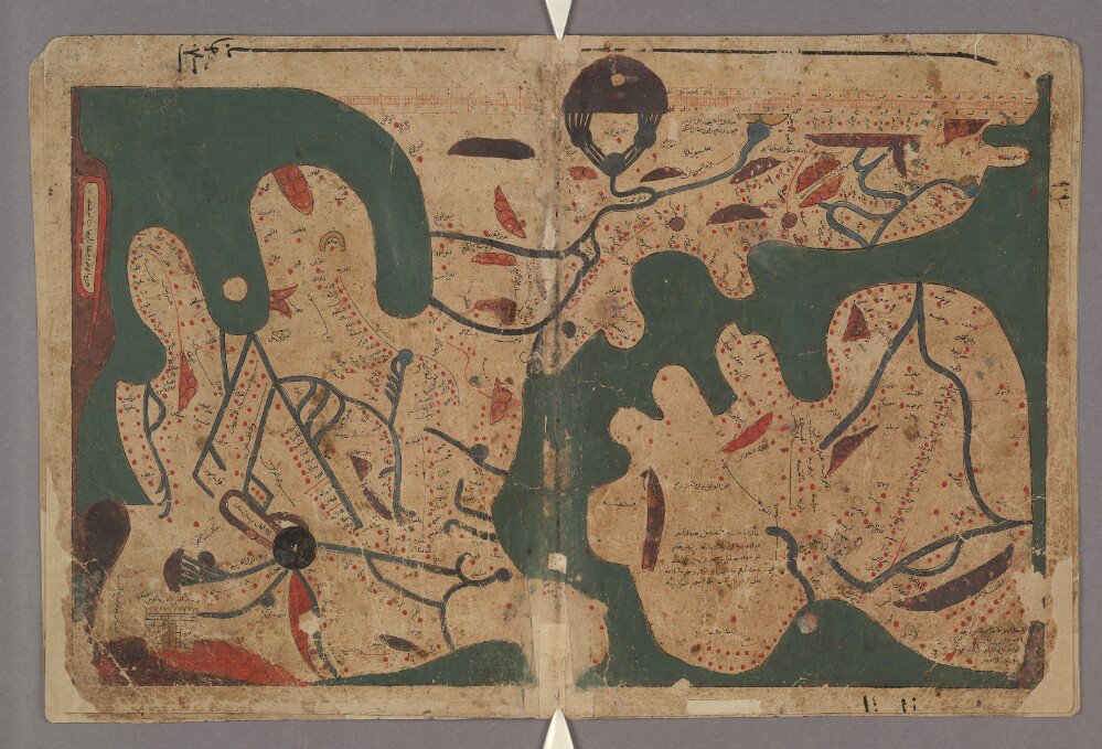
There are 17 maps in the Fatimid manuscript Book of Curiosities, 14 of which are completely unique to this manuscript. Perhaps the most remarkable is this rectangular map of the world. This the only such map to be dated before the renaissance that we know to have survived.
“The Book of Curiosities is one of the greatest achievements of medieval map-making; it is also a remarkable part of the story of Islamic civilization….It is a profoundly Fatimid treatise. Like a tirāz armband, it wears its allegiance to the Fatimid caliphs on its sleeve. This is apparent from the opening dedication, from the blessings heaped on the Fatimid imams” — Emilie Savage-Smith and Yossef Rapoport, authors of Lost Maps of the Caliphs.
About a millennium ago, in Fatimid Cairo, an unknown author completed a large and richly illustrated book. In the course of thirty-five chapters, this book guided the reader on a journey from the outermost cosmos and planets to Earth and its lands, islands, features, and inhabitants. This treatise, known as The Book of Curiosities, was unknown to modern scholars until a remarkable manuscript copy surfaced in 2000. Christie’s auction house in London, who had put up the manuscript for sale, wanted to know more about it and invited Professor Emilie Savage-Smith of Oxford University to examine the manuscript. As it turned out the manuscript was one of the most important discoveries in the history of cartography in recent decades, and was eventually acquired by Oxford University’s Bodleian Library. With Yossef Rapoport, then a young research assistant, Professor Savage-Smith, set out to critically study the manuscript and together they co-authored “Lost Maps of the Caliphs,” with the aim of providing the first general overview of The Book of Curiosities and the unique insight it offers into medieval Islamic thought.
“As tales of scholarly finds go, this is up there with the best….Lost Maps of the Caliphs is a testament both to the scholarship of its authors and to the spirit of inquiry fostered by the Fatimids.” — The Daily Telegraph, London.
The article that follows below was originally published on Jadaliyya on April 8, 2019. We are deeply indebted to Bodleian Library Publishing, publishers of the UK edition of “Lost Maps of the Caliphs,” as well as The University of Chicago Press for facilitating the publication of the complete interview as well as an excerpt from the book on Simerg.
“Lost Maps of the Caliphs” has been acclaimed world wide in numerous reviews. In addition to the very brief excerpt that has been quoted here from London’s Daily Telegraph, the following quote from Imago Mundi goes on to validate the book’s outstanding content: “We are fortunate indeed that Rapoport and Savage-Smith have undertaken fifteen years of meticulous, collaborative research on the Book of Curiosities. The culmination, Lost Maps of the Caliphs, is an exceptional tribute to an exceptional object of study.”
~~~~~~~~
Interview with Yossef Rapoport and Emilie Savage-Smith, authors of Lost Maps of the Caliphs
Jadaliyya (J): What made you write this book?
Yossef Rapoport and Emilie Savage-Smith(YR and ESS): This book started with a discovery. In September 2000, a specialist in Islamic manuscripts at Christie’s auction house in London called Emilie—who specializes in the history of Islamic science—and asked her if she could come into London from Oxford and look at a puzzling Arabic manuscript that was up for sale a couple of weeks later. It was entitled Kitāb Gharāʾib al-funūn wa-mulaḥ al-ʿuyūn, which loosely translates as “The Book of Curiosities of the Sciences and Marvels for the Eye.” Christie’s didn’t know what to make of it, and wanted to seek Emilie’s advice about its importance.
Emilie was shown a rather scruffy manuscript, bound in ill-fitting covers, with a bird-dropping visible on the cover. But inside the covers was a medieval Arabic treatise on the skies and the Earth, accompanied by a series of strange images and maps unparalleled in any other medieval work. Above all, it had a map of the world with a scale of degrees of longitude at the top, in what seemed to be the earliest surviving example of mathematical plotting on any world map known to us.
The manuscript turned out to be one of the most important discoveries in the history of cartography in recent decades. With the support of Oxford colleagues, Emilie began a campaign to ensure the work would be available to the public rather then be kept by private collector. In June of 2002, it was acquired by the Bodleian Library at the University of Oxford, with the help of the National Lottery Fund. Yossi then joined as (then) a young research assistant. We first established that the treatise was written in the first half of the eleventh century, in Cairo, the newly-founded capital of the Fatimid Shi’a Empire. We then spent the following decade carefully preparing a critical edition and annotated translation of the maps and text, published by Brill in 2014.
Our critical edition made the treatise and its maps available for scholars, but it did not explain what they mean or why they are so important. We strongly felt that merely translating the text and presenting the images—beautiful and striking as they are—was not enough. The treatise had to be understood as a whole, because the maps of the sky and of the Earth, of the Indian Ocean and of the Nile, of Sicily, of Mahdia, and of southern Anatolia, all made sense only when read together in the context of the society and culture in which they were produced. Lost Maps of the Caliphs tells the story of this exceptional manuscript—how it was discovered and why it is so significant.
J: What particular topics, issues, and literatures does the book address?
YR and ESS: Because the treatise is so wide-ranging, we use it to reconsider the development of astronomy, astrology, geography, and cartography in the first four centuries of Islam. In the Lost Maps we outline the medieval Islamic understanding of the structure of the cosmos and celestial phenomena. The amalgamation of Hellenistic, Coptic, Hindu and other star lore was all channeled towards an astrological mind-set. The Earth together with the Heavens formed the universe of eleventh-century Cairo. To a medieval person, whose night skies were not blanked-out by city lights and pollution, the contents of the night sky—the ‘Raised-Up Roof’ as our author, following the Qur’an, called it—revealed the workings of the universe and, if properly understood, heralded events on Earth.
Our book is also a contribution to the history of global communication networks at the turn of the previous millennium. We use the geographical materials of the Book of Curiosities to depict the Fatimid Empire as a global maritime power, with tentacles of military and religious authority in the Eastern Mediterranean, the Indus Valley, and along the East African coast. The extent of Fatimid knowledge of Byzantine coasts demonstrates close ties between the Muslim and Christian empires. The material on East Asia sheds new light on Sino-Indian trade routes and is very surprising for a treatise written in Egypt. The treatise’s familiarity with the East African coasts contributes to recent debates on the Islamization of the Swahili coast.
Perhaps most importantly, we use the Book of Curiosities to re-consider the history of early Islamic map-making. The world map of the Book of Curiosities is a result of the dialogue of the Islamic world with Hellenistic, Late Antique geography. The extensive maritime material in the Book of Curiosities sheds new light on navigation in the Mediterranean and the Indian Ocean before the introduction of the compass in the thirteenth century, and presents an Islamic angle on debates concerning the origins of the European portolan chart.
J: How does this book connect to and/or depart from your previous work?
YR and ESS: Emilie has been working on Islamic scientific manuscripts for several decades, and published books on Islamic celestial globes, medieval Islamic magic and divination, and a catalogue of the medical manuscripts in the Bodleian Library. She also co-authored the volume on Medieval Islamic Medicine that won the 2008 Book Prize in Middle Eastern Studies of the British-Kuwait Friendship Society. It was Emilie’s vast experience with Islamic scientific manuscripts that enabled her to appreciate how special this treatise was. In Lost Maps of the Caliphs, Emilie also wrote the chapters that deal with astronomy and astrology, as well as providing a very personal chapter about her campaign to make this gem available for the public.
Yossi came to this project with training in the history of Arabic-speaking medieval Islamic societies, shortly after competing a PhD on the history of marriage and divorce in late medieval Egypt. But, like so many, he was always fascinated with maps, and the deciphering of the maps of the Book of Curiosities was as close as one gets to deciphering a fairy-tale treasure map. Through this project, he became an expert on Islamic maps, navigation, medieval trade routes between India and China, and Hellenistic collections of strange animals.
J: Who do you hope will read this book, and what sort of impact would you like it to have?
YR and ESS: We hope that this book will be widely read as a window onto medieval Islamic views of the world, a perspective on Islamic science that is missing from current debates about the legacies of Islamic civilization. The Book of Curiosities is one of the greatest achievements of medieval map-making; it is also a remarkable part of the story of Islamic civilization. Too often, the achievements of Islamic science are divorced from the culture that produced them and are only brought to light as a trophy in a sterile competition with West. Islamic maps in particular get almost no attention in surveys of Islamic history, and even when they are shown they are rarely explained. Because we tend to view Islamic civilization through the prism of religion and faith, we find no use for these abstract diagrams that tell us nothing about God.
What could be more foundational to any culture than the manner in which it conceived of the sky and the Earth? We hope to show that the discovery of the Book of Curiosities is also a timely rediscovery of those aspects of Islamic history which are too often neglected in academic and non-academic visions of Islam. It is a rediscovery of the sea as an integral part of a civilization that supposedly originated in the desert, of an outward looking scientific enquiry that was built on the foundation of the classical Greek legacy, and of the power of the image in a culture that is too often reduced to texts.
J: What other projects are you working on now?
YR and ESS: It is about time to put the Book of Curiosities behind—it is nearly twenty years since we started working on it. Emilie came back to the history of Islamic medicine and is now completing a mutli-volume translation of a thirteenth-century Syrian biographical dictionary of doctors, to be published by Brill, with selections in the Oxford World Classics series published by Oxford University Press.
Yossi has been working over the past few years on the history of the medieval Islamic countryside. He recently published a monograph, Rural Economy and Tribal Society in Islamic Egypt, whichis a detailed micro-study of the economy and society of the villages of the Egyptian province of the Fayyum as described in a unique thirteenth-century tax register. This book, too, has a lot of maps, mostly modern GIS ones but also a copy of one that was originally made in the tenth century.
~~~~~~~~
Excerpt from Lost Maps of the Caliphs by Yossef Rapoport and Emilie Savage-Smith
Who, then, was the author of the Book of Curiosities? His apparent access to naval military records suggests a direct connection to the Fatimid state. His personal acquaintance with an Ismaʿili missionary who had been to Nubia, and his unique information on itineraries in the world of the Indian Ocean, all suggest he was close to the Ismaʿili missionary network. The map of Palermo with its suburbs, the diagram of Tinnīs, and in particular the map of Mahdia, which is drawn from the perspective of someone looking at the city from a vantage point just outside of its walls, suggest that he had visited these port cities in person. In some ways, he is a successor to the geographer Ibn Ḥawqal and a predecessor of the poet Nāser-e Khosraw—both Ismaʿili missionaries, travelers and keen observers of human societies. Unlike them, however, his interest in trade is minimal, and he is more likely to have been a military man than a merchant. Nor was he a scholar of the caliber of his Egyptian contemporaries, the physician Ibn Riḍwān or Ibn Haytham, the founder of the science of optics. His grasp of mathematical concepts appears to have been quite poor, and he generally avoided technical discussions.
Rather than a scholar our author was, primarily, a mapmaker. It is the maps that make the Book of Curiosities such a distinct work of medieval scholarship and such an appealing manuscript for modern audiences. The author has unprecedented confidence in the ability of maps and diagrams to convey information. Unlike any other geographical treatise before this, the maps are stand-alone artifacts, unsupported by any accompanying text. This is true for some of the maps of the sky, but especially for the rectangular map of the world, the maps of the three great seas, and the maps of the rivers. Even when the maps are related to a text, such as those of the islands of Sicily and Cyprus, or the city of Mahdia, the information they contain goes well beyond that of the preceding prose sections. We do not have the original treatise, only a later copy, so we do not know how lavish it might have been when first penned. But the second part of the title literally translates as “that which is pleasant to the eyes” (mulaḥ al-ʿuyūn), indicating that this treatise was about the images as much as it was about the text.
article continues after image
A photo of the UK edition of Lost Maps of the Caliphs by Yossef Rapoport and Emilie Savage-Smith, published by Bodleian Library, University of Oxford. Please click on image to see book details.
Maps are at the center of this Book of Curiosities, and this anonymous mapmaker offers us his reflections on the craft of cartography. His chapter on mapmaking techniques introduces the maps of seas and islands, the most original maps in the treatise. He opens with a formulation of the purpose of his maps: “Although it is impossible for created beings to know the extent of God’s creation, the knowledgeable and qualified among them are entrusted with witnessing or imparting a small part of it.” The maps that will follow will convey knowledge, albeit imperfect, of God’s creation. He then continues to explain why his maps are intentionally “not accurate representations” of reality: the contours of coastlines change over time, the mapmaking instruments are not fine enough to reproduce reality on a small scale, and labels need to be legible. Here is a mapmaker explaining his choices and reflecting on the purposes and functionality of his maps. The results of his labor are unique medieval versions of “graphic representations that facilitate spatial understanding,” to use the definition of “map” by the leading modern historian of cartography. There is no parallel for this passage in any other medieval treatise known to us.
The Book of Curiosities is a profoundly Fatimid treatise. Like a tirāz armband, it wears its allegiance to the Fatimid caliphs on its sleeve. This is apparent from the opening dedication, from the blessings heaped on the Fatimid imams, and from the curses flung at the rebels who sought to overthrow them. The treatise also reflects some immediate political ambitions of the Fatimid state, especially in the Mediterranean. It depicts visually and in text the defenses of the strategic Fatimid holdings in Tinnīs, Mahdia, and Sicily. There are historical references to the early Islamic conquests of Cyprus, Crete, and Bari, with the inference that they may be ripe targets for Fatimid re-conquest. The mapping of anchorages, ports, and bays deep in Byzantine territory, some of them as far north as the Dardanelles, also reflect a military context. It is likely that much of the material here was actually drawn from the records of the Fatimid navy. And beyond the immediate political objectives, the maritime focus of the Book of Curiosities is also distinctly Fatimid. The unusual categories for organizing the geographical material, from seas to islands, and then to lakes and rivers, reflect the unique maritime orientation of the Fatimids, who, alone among the great medieval Muslim empires, preferred networks of ports, rivers, and islands over horses and land routes.
The treatise can be viewed as part of a westward shift in the geographical tradition and in the center of gravity in the Islamic world in general. Most ninth-century works, such as those by Ibn Khurradādhbih and the Relation of China and India, focused on Asia and the Indian Ocean. By the middle of tenth century, however, the gaze shifts to the Mediterranean, North and Sub-Saharan Africa. Al-Masʿūdī spent much of his later life in Egypt and Syria, and Ibn Ḥawqal provided an unprecedented account of the Maghreb. The eleventh-century Book of Curiosities focuses on the eastern Mediterranean. Later works of the Andalusian author Abū ʿUbayd al-Bakrī (d. 1094) and, of course, the Sicilian based al-Idrīsī (fl. 1154) have their focal point even farther to the west. The heavy reliance of the Book of Curiosities on the work of Ibn Ḥawqal is also suggestive, because the latter was, most likely, also a missionary. The focus on islands in the Book of Curiosities may have had special resonance against the backdrop of the Ismaʿili nomenclature of regional “islands.”
The Ismaʿili context of the Book of Curiosities invites comparisons with the influential Epistles of the Brethren of Piety, an encyclopedic corpus of science and Neoplatonic philosophy, composed in Iraq sometime before the middle of the tenth century. The Epistles are not cited in the Book of Curiosities, nor is there evidence for their circulation in Fatimid Egypt, despite their affinity with Ismaʿili teachings. Yet the Epistles seem to approach the subject matter of the sky and the Earth in a similar manner. Following the Greek astronomer and geographer Ptolemy, geography is seen in the Epistles as an appendix to the study of the stars. But the Epistles also have a higher purpose: the reader is invoked to contemplate the design of the creator, “to ponder wonders (ʿajāʾib) of his creation and reflect on the curiosities (gharāʾib) of what he fashioned.” This desire to observe God’s work explains some of the interest in marvels and wonders exhibited by the Book of Curiosities, as its title suggests.
Like the Epistlesof the Brethren of Piety, the Book of Curiosities draws heavily and without compunction on the heritage of Greek science. Ptolemy, Hippocrates, and Galen provide our author with much of the material on the general structure of the heavens and the Earth, and on the way the former influence the latter. Muslim scholars like al-Masʿūdī correct and add information, especially when one zooms in on the Earth’s size and layout, but the general framework inherited from the Greeks is not questioned. And while God is omnipresent, the Qur’an is cited sparingly, only to invite reflection on creation or to buttress moral points about God’s punishment meted out to the unbelievers. There is only one Tradition from the Prophet in the entire treatise, on the intrinsic purity of water. Such reliance on a Hellenistic heritage was not uncommon in eleventh-century Cairo. Mubashshir ibn Fātik, a wealthy and influential scholar, left us a remarkable collection of ethical sayings from the Greek sages, with special focus on the Late Antique and legendary Hermes.
The author of the Book of Curiosities does not limit himself to Greek authorities, but is also acquainted with Persian, Indian, and Coptic knowledge. He cites an account of the birth of astrology in India, and Persian authorities on the ominous bābānīyah stars. He is also keen to show command of multiple languages. For example, the names of each planet are given in Persian, Classical Greek, “Indian,” and Byzantine Greek; the names of each day of the week are given in Persian, Byzantine Greek, “Indian,” Hebrew, and Coptic. The use of Coptic is of special significance. There is here a deep influence of Egyptian Coptic traditions, an influence which has been overlooked in modern scholarship on Islamic science. Coptic lore was already reworked by al-Masʿūdī, and the Coptic calendar seems to have been used very early when predicting the risings of the lunar mansions. There is even more Coptic material in the Book of Curiosities, including accounts of the moray eel and the foundation of Tinnīs. Most importantly, the explanations related by Copts regarding the flooding of the Nile—that the Nile floods are a result of the summer melting of the snow on equatorial mountains—are as close to the present understanding of the Nile system as was ever achieved by medieval Islamic scholarship.
Date posted: January 26, 2020. Last updated: February 3, 2020.
Before departing this website please take a moment to review Simerg’s Table of Contents for links to hundreds of thought provoking pieces on a vast array of subjects including faith and culture, history and philosophy, and arts and letters to name a few.
[Numerous reports in the Iranian media in November 2014 announced that Iran was planning to offer the castle of Alamut to UNESCO as a World Heritage Site. The historical significance of the fortress dates back to 1090 A.C. when the Ismaili dai Hassan Sabbah chose the Alamut region as the headquarters of Ismailis following the Nizari-Musteali split in Fatimid Egypt. But four years after the announcement, Iran Daily reports that numerous factors have prevented the registration of Alamut as a World Heritage Site site.]
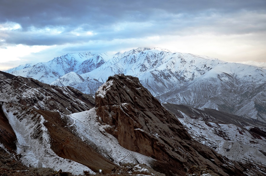
A winter view of the unassailable rock of Alamut and the famous castle of Alamut nesting on top of this huge mountain of granite stone. This was the Capital of a Confederation of the Ismaili State founded in 1090 AC, by a great genius of all times, Hasan-i Sabbah which lasted for 171 years against formidable enemies and ultimately surrendered before the Mongols in 1256 AC. The Ismaili State was defended by a string of castles, over one hundred in number and Alamut being the capital of the State. This photo of was taken on December 31, 2011 by Alireza Javaheri. Photo credit: Wikipedia. This file is licensed under the Creative Commons Attribution 3.0 Unported.
By CULTURAL HERITAGE DESK, IRAN DAILY
Alamut located in the northwestern province of Qazvin as an untapped and historical region deserves to be registered on UNESCO’s World Heritage List but various factors have prevented the goal from being reached.
Director General of Qazvin Cultural Heritage, Handicrafts and Tourism Department Mohammad Ali Hazrati said that a limited number of foreigners travel to Qazvin Province because it doesn’t have any registered site on UNESCO’s World Heritage List.
He added efforts are underway to send the dossier of Alamut natural and historical site to UNESCO for world registration.
Hazrati said Alamut with beautiful natural landscape has several ancient structures including Hassan Sabbah Castle and Pich Bon Caravanserai.
A number of regulations should be observed for registration of any site on UNESCO’s List.
“Illegal construction of buildings within the boundary of the historical structures, including Hassan Sabbah Castle, is among the problems faced by Alamut in this respect”, he said.
He added that a decree was issued for destruction of structures located in Alamut historical texture, but the resistance of local officials as well as some social considerations prevented it from being enforced.
Hazrati said the registration of Alamut on UNESCO’s World Heritage List would help the ancient site to be recognized more internationally, draw a large number of the visitors to the province and boost tourism and employment in the region.
The Former head of Iranian Center for Archeological Research, Hamideh Choobak, said all ancient sites located worldwide are of high value but international recognition would help increase the governments’ responsibility to protect and maintain them.
“Specific funds will also be made available to the sites by the government and international organizations”, she added.
Choobak, who is the head of Alamut Cultural Heritage Site, noted that Alamut deserves to be registered on UNESCO’s List but it is not enough.
She stressed that a number of conditions should be provided to help realize the target.
The Milky Way extends across the sky above the mountain fortress of Alamut in this all-sky view from Iran. The light dome at the lower right is from the capital Tehran, over 100 kilometers away to the southwest. The light on the upper right is from Qazvin, the closest major city to Alamut. Photo: Copyright. Babak Tafreshi/Dreamview.net.
The official said Hassan Sabbah Castle has been registered on the National Heritage List in the year to March 2002, adding some organizations failed to perform their responsibility toward the structure.
She reiterated that related organizations should raise the local people’s awareness about the benefits of the site’s registration on UNESCO’s List and encourage them to cooperate with officials in this respect.
Here are links to 2 amazing stories about the discovery off the coast of Israel of 2580 dinars minted during the reigns of Fatimid Ismaili Imams Al-Hakim and Al-Zahir. The BBC story has just been posted on the BBC travel website. A link to an earlier story appears after the BBC link.
1. From the BBC: The city with a hoard of Fatimid gold
On an overcast morning in February 2015, Zvika Fayer was scuba diving off the ancient Israeli port town of Caesarea when he saw a glimmer on the sand. Fayer reasoned that the gleam must have been a discarded sweet wrapper….But as he swept the sand away and picked the item up, he saw that he was wrong. This wasn’t a piece of foil; it was a real gold coin with Arabic script on both sides. The dates minted on them show that they were manufactured during the reigns of Caliphs al-Hakim (996–1021AD) and his son al-Zahir (1021–1036AD) when Caesarea was part of the Islamic Fatimid Dynasty.
In February 2015, divers off the coast of Caesarea spotted by chance a group of gold coins lying on the seabed. They immediately alerted marine archaeologists of the Israel Antiquities Authority (IAA), who conducted a salvage excavation at the site and recovered more than 2,580 Fatimid coins of pure (24 karat) gold weighing a total of 7.5 kg.
Please click on the image to view an on-line exhibit of the discovery.
The coins date from the mid-9th to the early 11th century CE. They were minted by the Fatimid caliphs of Egypt, and include dinars minted in al-Qayrawan, on the Tunisian coast, by Imam al-Mahdi (AH 297–322 = 910–934 CE), the founder of the Fatimid caliphate as well as a much larger collection belonging to the Fatimid caliphs Imam Al-Hakim (AH 386–411 = 996–1021 CE) and his successor Imam Al-Zahir (AH 411–427 = 1021–1036 CE).
Following the discovery, an exhibition was held from June to December 2015 at the Samuel and Saidye Bronfman Archaeology Wing of The Israel Museum in Jerusalem. Some very interesting data and information about the Fatimid coins was also posted on the Museum’s website, which includes topics such as the inscription on the coins, the coin’s purchasing power, the script, and the purity of the coins. We invite our readers to visit the website by clicking on http://www.imj.org.il/exhibitions/2015/caesarea/ or on the image shown above.
“THE ISMAILI IMAMAT REPRESENTS THE SUCCESSION OF IMAMS SINCE THE PROPHET MUHAMMAD” — HIS HIGHNESS THE AGA KHAN, 2014
INTRODUCTION TO THE SERIES
Mawlana Hazar Imam Shah Karim al Hussaini, His Highness the Aga Khan (pictured above), in direct lineal descent from the Holy Prophet Muhammad (s.a.s.) through Hazrat Ali (a.s.) and Hazrat Bibi Fatima (a.s), is the 49th Imam of the Ismaili Muslims. From the time of the first Imam Ali, who was designated and appointed as such by the Holy Prophet, the Imams of the Ismaili Muslims have ruled over territories and peoples in various areas of the world at different periods of history in accordance with the Islamic precepts and ethics of unity, brotherhood, justice, tolerance and goodwill. The Ismaili Imam is therefore not only concerned with the material advancement and the improvement of the quality of life of his Ismaili followers, but also that of other Muslim communities and societies at large in which they live.
In accordance with historical and theological works and the teachings of their Imams, the Ismailis believe that each Imam is the bearer of the Light of Imamat (or Nur). This (spiritual) Light is with the Ahl al-bayt (i.e. the Imams from the Prophet Muhammad’s family). This Nur was with the first Shia Imam Ali and, for Shia Ismailis, is now with their present 49th Imam. Every Imam guides his followers during his time through the Nur of Imamat.
The Nur of Imamat is always there to guide through the physical presence of the Imam. The Imam holds his followers hands and leads and protects them in both difficult and good times. He shows them how they should live in a particular time and place. Just as the water of a river continues to flow, the Hereditary line of Imamat from Hazrat Ali never stops. That is, the Imam is always physically present and manifest on this earth. According to Shia tradition, the Imam is the threshold through which God and the creatures communicate. He is thus a cosmic necessity, the key and the center of the universal economy of the sacred: “The earth cannot be devoid of an Imam; without him, it could not last an hour. If there were only two men left in the world, one of them would be the Imam.”
One of the goals of each Ismaili is to strive to come closer to the spiritual light of the Imam. One can do so by fulfilling one’s material and spiritual responsibilities to the best of one’s ability. Praying regularly, living by the ethics of Islam, following the Imam’s guidance strengthens the Ismailis’ spiritual bond with their Imam, and through his Light, brings them closer to Allah.
In the coming days, weeks and months Simerg will endeavour to provide different perspectives on the Imamat and Ismaili contributions to Islamic culture and thought from various literary works on Ismaili philosophy, theology and history.
Beatific Vision of the Imam
The [Imam’s] beatific vision is of two kinds: one a physical meeting with the Imam and the other a spiritual recognition of his essence [Nur], through which God is recognized.
Speaking of the second of these, Pir Sadr al-Din, in his ginan [religious hymn] “Sakhi māhā pad keri vāt koek jānere”, writes:
Friend! None but a few know of the exalted station. Indeed, they alone recognize it who have found the true guide.
Friend! Within the heart, at the confluence of the three spiritual rivers, there is an imperishable light. There – a shimmering effulgence, pearls are showered.
Friend! I completely lost consciousness of my physical self when my meditation mounted the empyrean, bursting forth.
Friend! I beheld the place of the lofty throne, I saw the seven islands, the nine continents.
Friend! The religious scriptures and books cannot fathom this, for there is neither day there, nor night, neither sun, nor shade.
Friend! My Lord is not such that He can be spoken of. He is to be seen – for He is indescribable, and nameless.
Friend! How sweet is that Lord, indescribable, nameless. Says Pir Sadr al-Din, truly, with my own eyes, I have seen Him!
~~~~~~
Dazzled by the Light of Imamat
When Ismaili missionary al-Mu’ayyad-din Shirazi had left Shiraz in Persia for Fatimid Egypt, he was very hopeful that he would get the opportunity to see the Imam-Caliph Mustansir-bi-Allah, but at the same time he had also feared the intrigues of the ministers who did not permit any man of learning to see the Imam personally, unless he complied with their dictates and acknowledged their superiority.
On reaching Egypt he experienced all that he had feared. He was lodged in a small house and his visits to the court were short and limited to prevent him from seeing the Imam.
Disappointed, he finally decided to leave Egypt and wrote as follows to Tastari, one of the most powerful persons in the Fatimid State:
“I have not come to Egypt to seek wealth or gain any position. The promptings of my faith have brought me here. I have come to visit the Imam and not the Vaziers and their officials. Unfortunately, these people stop me from having a look at my Imam and now I am returning disappointed.”
The sudden death of Tastari gave al-Mu’ayyad another opportunity to renew his efforts to get some time to be in the holy presence of the Imam and with some help was finally able to pay respects to the Imam. Describing his experience, he writes:
I was taken near the place where from I saw the bright Light of the Prophethood. My eyes were dazzled by the Light. I shed tears of joy and felt as if I was looking at the face of the Prophet of Allah and of the Commander of the Faithful, Hazrat Ali. I prostrated myself before the one who is the fittest person to bow to. I wanted to say something, but I was awe-struck.
I tried to speak but my tongue refused to move. People asked me to say what I wished to say. I could say nothing. The Imam said, ‘Leave him. Let his fear and awe subside’.
After this, I rose. I took the holy hand of the Imam, placed it on my eyes and on my chest and then kissed it. I left the place with immense joy.
~~~~~~
Imam Mu’izz’s Arrival in Cairo
In 969 CE, Imam al-Mu‘izz, “an excellent planner, an efficient organiser and a statesman amply talented in diplomacy,” with the help of his general Jawhar Siqilli, acquired Egypt peacefully.
During this time the building of the new city of Cairo began and in 970 CE the foundation for the al-Azhar mosque was laid. The Imam himself arrived in Cairo in 973 CE in a very touching ceremony. His sons, brothers and uncles, and other descendants of Imam al-Mahdi, the first Fatimid caliph, made their entrance with him. Imam Mu’izz brought with him the coffins of his ancestors Imams al-Mahdi, al-Qa‘im and al-Mansur.
Stanley Lane-Poole’s description of Imam al-Mu‘izz may aid one to understand his successful reign:
He was a born statesman, able to grasp the conditions of success and to take advantage of every point in his favour. He was also highly educated, and not only wrote Arabic poetry and delighted in its literature, but studied Greek, mastered Berber and Sudani dialects, and is even said to have taught himself Salvonic … His eloquence was such as to move his audience to tears. To prudent statesmanship he added a large generosity, and his love of justice was among his noble qualities.
Cairo’s location between Africa and the Mediterranean ensured that it became a large, thriving commercial centre.
The greatness of the Fatimid Capital is described in the following words by Al-Muqaddassi, a notable medieval Arab geographer who lived in the tenth century.
Know that Baghdad was great in the past, but is now falling in ruins. It is full of troubles, and its glory is gone. I neither approve it nor admire it, and if I praise it, it is a mere convention. Fustat (today, part of old Cairo) is today where Baghdad was in the past, and I do not know of any greater city in all of Islam.
~~~~~~~
Imams are our Spiritual Parents
In the Shia tradition, the teaching of the Imam (also referred to as the Ta’lim of the Imam) lights his follower’s path to spiritual enlightenment and vision.
The spiritual enlightenment or the elevation of the soul gained by following the Imam’s guidance is described in many works by Shia theologians, and is particularly evident in the Ginans, Qasidas and narrative accounts written by Ismaili Pirs and missionaries.
The following excerpt is from a work by the Ismaili missionary, Muayyad-din-Shirazi:
Look at the trouble your parents have taken from the days of your childhood in the growth of your bodies and in the improvement of your physical life on earth. But for the interest they took in you, you would not have been what you are.
Your souls are thousand times more important than your bodies. The Imams are your spiritual parents.
Avail yourselves of a few days of life which are at your disposal here and look after your spiritual elevation under the care of your spiritual parents.
Once you miss this opportunity, you will repent forever. You will not be given a second chance to set things right.
~~~~~
Imam’s Favours Cannot be Counted
From a work by renowned Fatimid scholar and jurist, Qadi Numan.
Let us make a short survey of their favours on us. We were ignorant of everything and were spiritually dead. They brought us back to life and showed us the path of wisdom. We were blind, they gave us the eyes to see for ourselves what is right and what is wrong.
We were groping in the dark, they showed us the light. We had lost the track, they showed us the way to salvation. We were lacking in knowledge, they gave us knowledge. We were falling in hell-fire, they picked us up and put us in the middle of righteous.
In short, they have done us the favours which we cannot count.
They have given us all that is good in this world and the world to come.
Date posted:May 1, 2017.
________________________
The material for this post was compiled and adapted from the following sources:
“…In the Ismaili tradition, al-Qāḍī al-Nuʿmān is the most famous author…He debated this Ḥanafī jurist about ijtihād and thought that he’d won, and then he heard afterwards that the man had written a fascicle still arguing his point against al-Qāḍī al-Nuʿmān. So then he thought: I really need to write a serious refutation to put an end to this…” — Professor Stewart, Emory College, Atlanta, USA.
M. Lynx Qualey, an Arabic literature blogger based in Egypt, conducted an interview with Professor Devin Stewart of Emory College on the Fatimid jurist Qadi al-Nu’mān, who served four Ismaili Imams for more than sixty years. The interview is based on Disagreements of the Jurists, one of the foundational legal texts of Ismaili Islam, which was translated recently by Dr. Stewart. Among other interesting matters, Qualey asks Professor Stewart about why al-Nu’mān’s book is important in understanding Islamic legal traditions and the Fatimid Empire, why medieval scholars thought it was classier not to cite their sources, and why a minority tradition would feel the need to conform to the shape of the majority….Read the interview.